VD-17, 23:257416G; Alden-Landis, 619/94; Shirley, 300A.
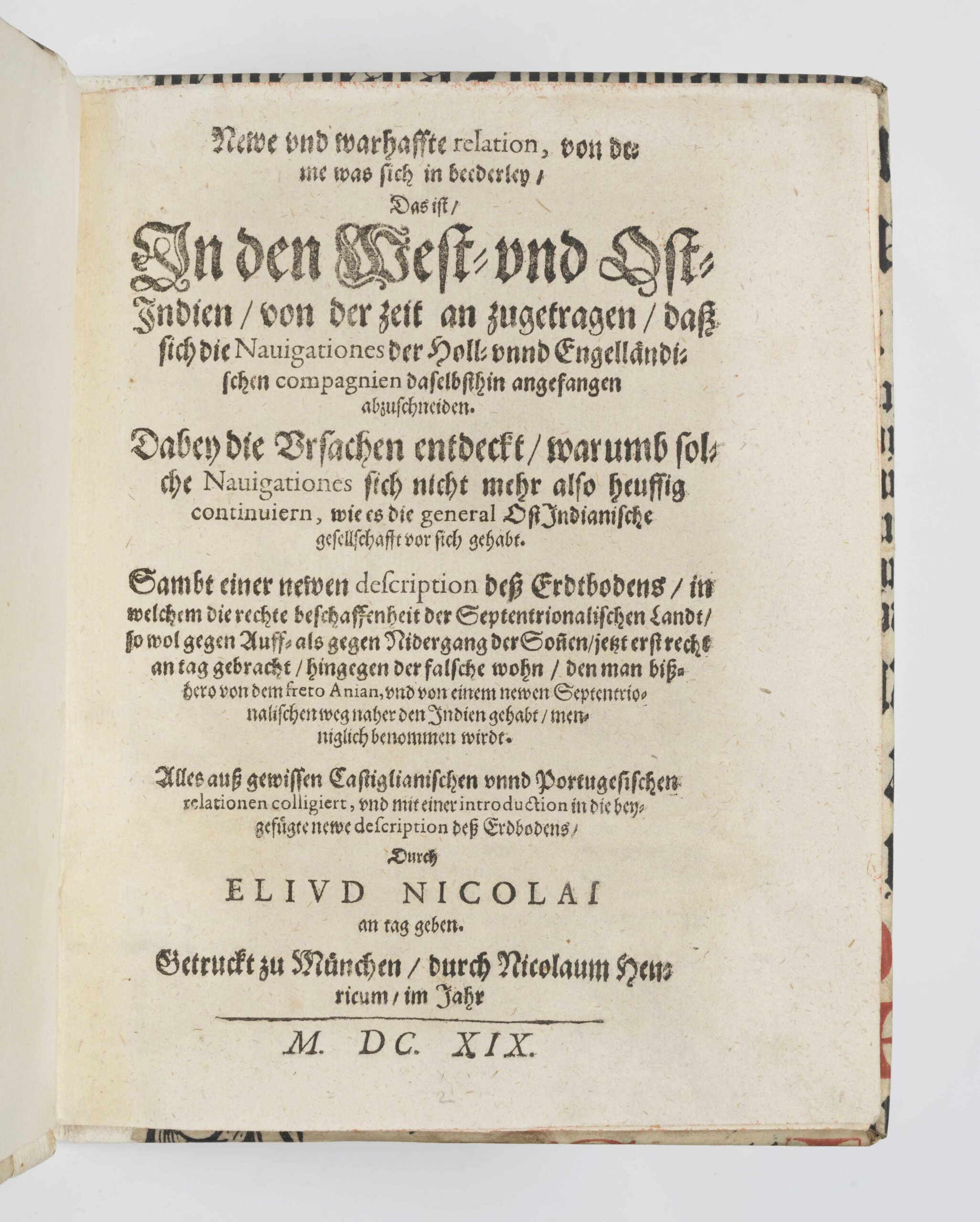
First edition of this compilation by Nicolai Eliud with many details on discoveries in Asia, Goa, Pegu, and the Phillippines, as well as on the advancement of the Dutch and English in the East Indies.
“Considerable detail about affairs in Portuguese Asia became available with the 1619 publication of Eliud Nicolai’s New und wahrhaffte Relation. Translated from or extracted from unnamed Spanish and Portuguese sources, Nicolai’s book describes the Portuguese discoveries in Asia, the conquests of Goa, of Pegu, and of the Philippines, the intrusion of the Dutch and English into the East Indies, and the conflicts between them and the Iberians. Recent events are treated with more detail than earlier events. One chapter describes can Spilbergen’s voyage, for example and several chapters are devoted to the exploits of Felipe de Brito and the growth of Portuguese influence. Victories over the Dutch are celebrated. It is a collection of pieces rather than a continuous narrative, and most of them recount European activities in Asia. There are a few descriptive passages, however, notably of Madagascar and Sumatra” (Donald Lach & Edwin Van Kley, in: Asia and the Making of Europe, III, p. 520).
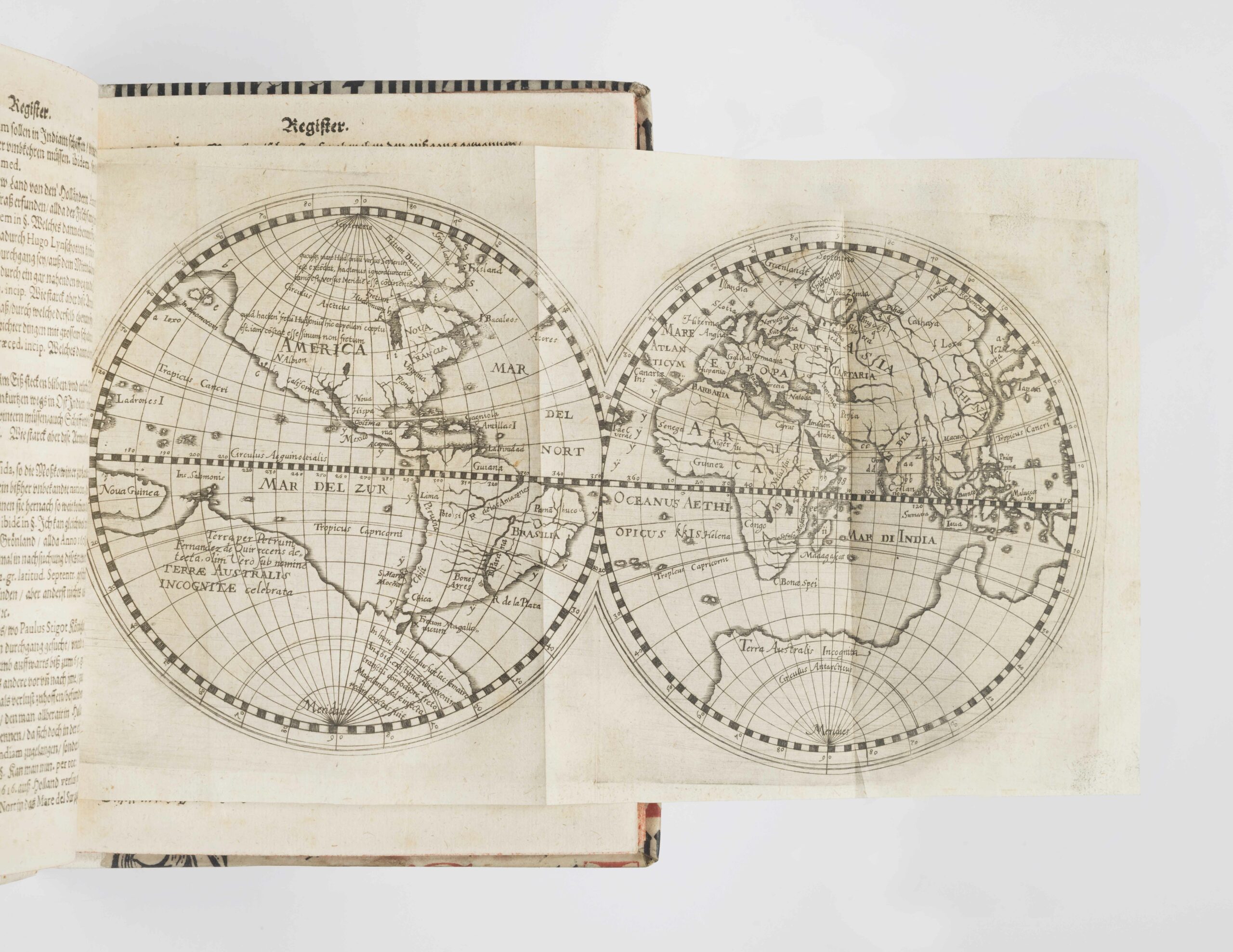
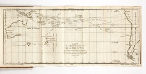
The book is illustrated with a fine world map based on the one by Hessel Geritsz of 1612.
“A close copy of Gerritsz’ map, with an added note on the strait dicovered by Le Maire in 1616, appeared in Eliud Nicolai’s Newe und wahrhaffte relation published in Munich in 1619″ (Shirley, 278).
“This uncommon travel book, dealing with the English and the Dutch voyages of discovery to the East and West Indies, and in particular the exploration in search of the north-west passage, has a world map at the front. it is based on the two carefully drawn hemispheres by Hessel Gerritsz, accompanying his Beschryvinghe... of 1612. Nicolai has diligently updated Gerritsz map. there are lines of text recording the passage of le Maire’s strait in 1616, further notes commenting on discoveries in North America, and additional place names. Some thirty-four legend references on the map are explained in four pages of text in the introduction of the book” (Shirley).
Nicolai mentions all of the important explorer in the preface having inspired his book including Lopez de Gomara, Christophe Colomb, Marco Polo, da Couto, Martin Forbisher, Gerard de Veer, Staden, and others.
Very good copy, complete with the rare map; title with small portions restored in the blank.