Brunet, III, 360 ; Quérard, IV, 152.
First edition.
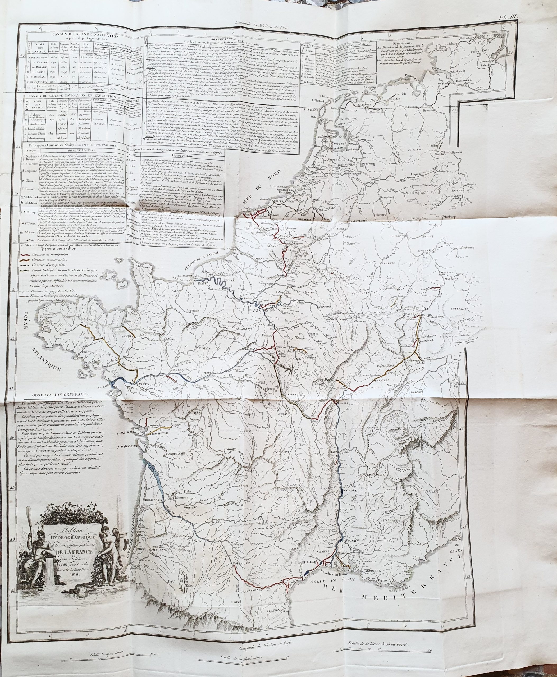
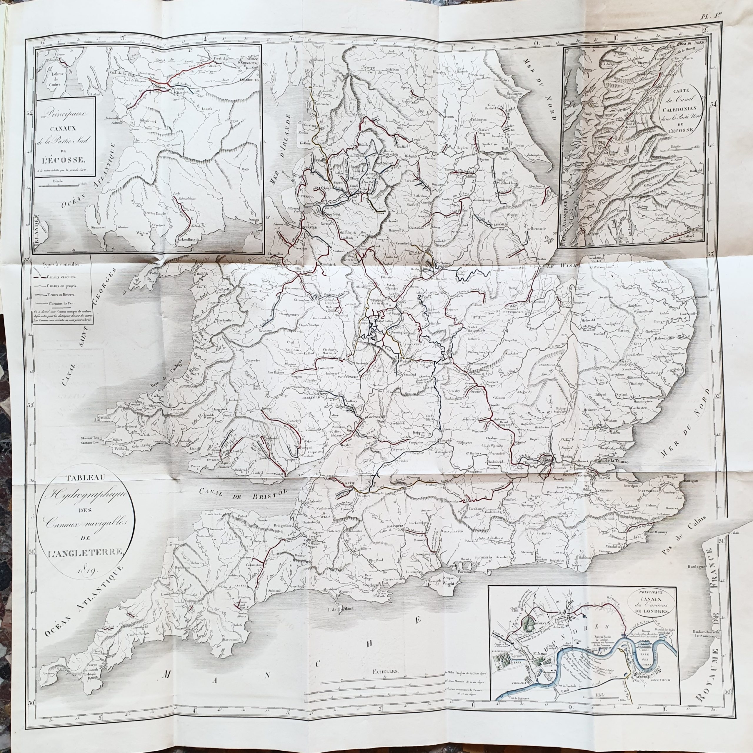
Huerne de Pommeuse (1765-1840), politician and economist, was the author of several works on the economic advantages of commercial canals in France and England, as well as on my Mediterranean and the Red Sea. The present work, his first on the subject of canals, concentrates on the canals of France (Briare, Languedoc, Givors, Centre, Burgundy, Orléans, Loing etc.) and England (London to Liverpool, Bridgewater, Grand-Truck, Coventry, Forth and Clyde etc.).
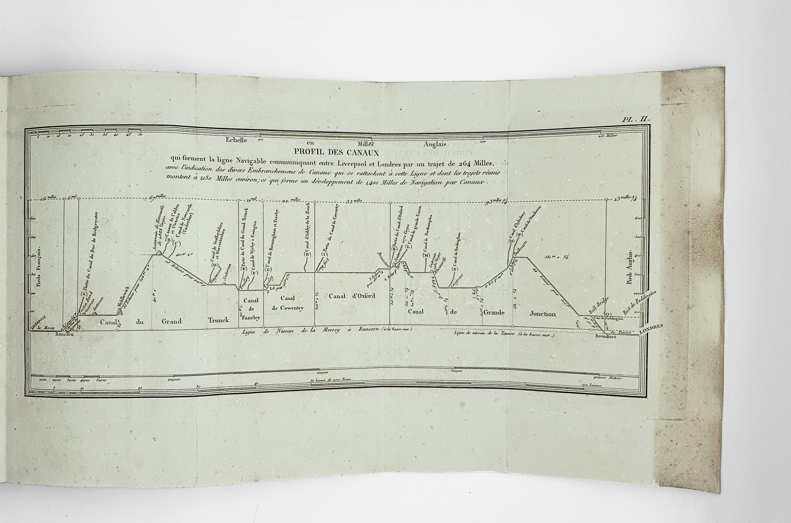
There is a detailed description of the navigable canals of England “which form the navigable line from London to Liverpool”, followed by descriptions of the canals of France. Huerne de Pommeuse devotes a large part of his study to promoting his new project to build “a lateral canal to the rarely navigable part of the Loire, which separates the Canal de Briare from the Canal du Centre”.
He states that: “We will demonstrate the necessity of this canal to form the complement of the great navigable line from north to south, whose advantages we will then see, and above all its influence on the system of inland navigation in France, which, by the variety of its products, the nature of its rivers and its geographical position, is perhaps the region where navigable canals can be most useful, and one might say most important” (p. 191).
The work was published on the occasion of the laws of 1821 and 1822 which organised major works throughout France. The atlas contains 13 maps, plans and profiles, the first two of which are devoted to England, the next 11 (2 of which are bound out of order) give details of canals and projects in France.
The text does contain the supplementary notebook ’56bis’ with pages 444/1-13.
Slight trace of light waterstain in the text volume. Nevertheless a very fine copy, nicely bound and complete with its 13 plates.